| ||||||||||||||||||||||
| copyrights 2011 |
Friday, February 27, 2015


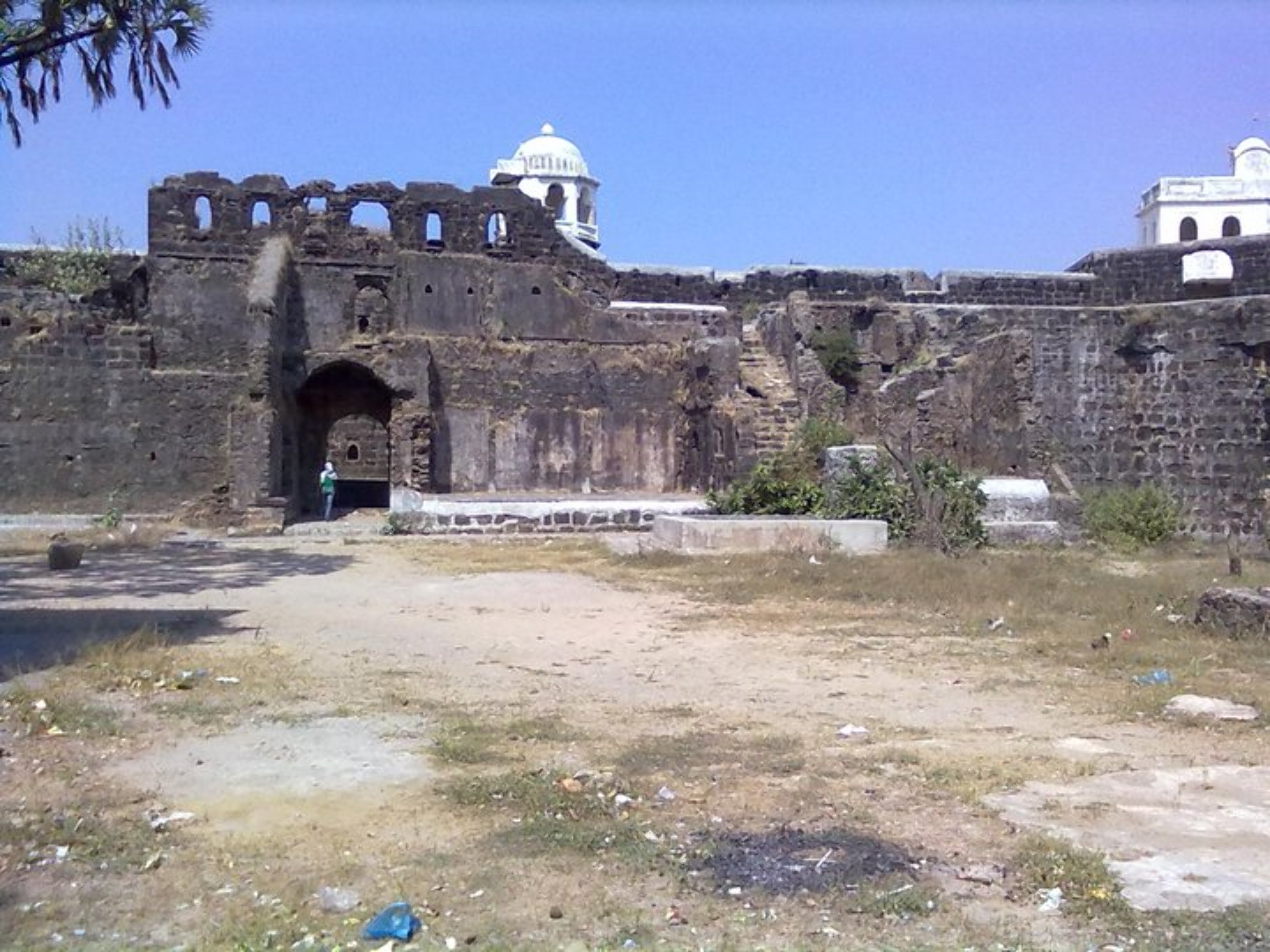
 There are plenty of cells and tunnels inside the fort and most of them are secret ones and yet to be found. Some of the cells/rooms were used as godowns. We decided to explore one such hidden cell in the south-eastern part of the fort. Just near the staircase we enter a small room in the fortification where we find a staircase leading to an open door in the upper wall of the room. After passing thru the door, we again climb a small spiral stairway, we reach a dark square hole/passage in the wall. This section will be about 2ft/2ft in size and one has to squeeze thru to pass by. After careful scrutiny of this passage, we climb up and reach the end of the passage which is wide at the end. There is an empty room at this place. On the right, there is a staircase, which takes us up to the south-eastern bastion. A good exploration-cum-adventure.
 The ramparts connect both these bastions to the rest of the fort walls. These bastions are completely broken and one can view the ground floor of the same. This area faces the sea which is about ½ km away. In the olden days the sea water used to reach right upto the fort walls and incase of bad weather, boats heading towards the north used to anchor on the trees which are on the western side of the fort walls. However now, the water has receded far away making the area marshy. Behind the fort one can see a small bund which brings in the sea water to irrigate the village fields. There is a small well inside the fort, which is now covered with creepers and bushes.
 woods towards the north side of the beach. We refer toP.K.Ghanekar's book and find a note on ‘Madla Bhruj'. We walk for about 15min thru the woods and reach this fortification. The only entrance to this fortification is thru the eastern side which is somewhat buried in the sand. On has to end and get inside. The second entrance is also in the same state after which we reach a balekilla kind of structure facing the sea shore on the west. The height of the fortification on this side is about 15-20ft (this would be the actual height of the bhurj). This small fort has 4 bastions.
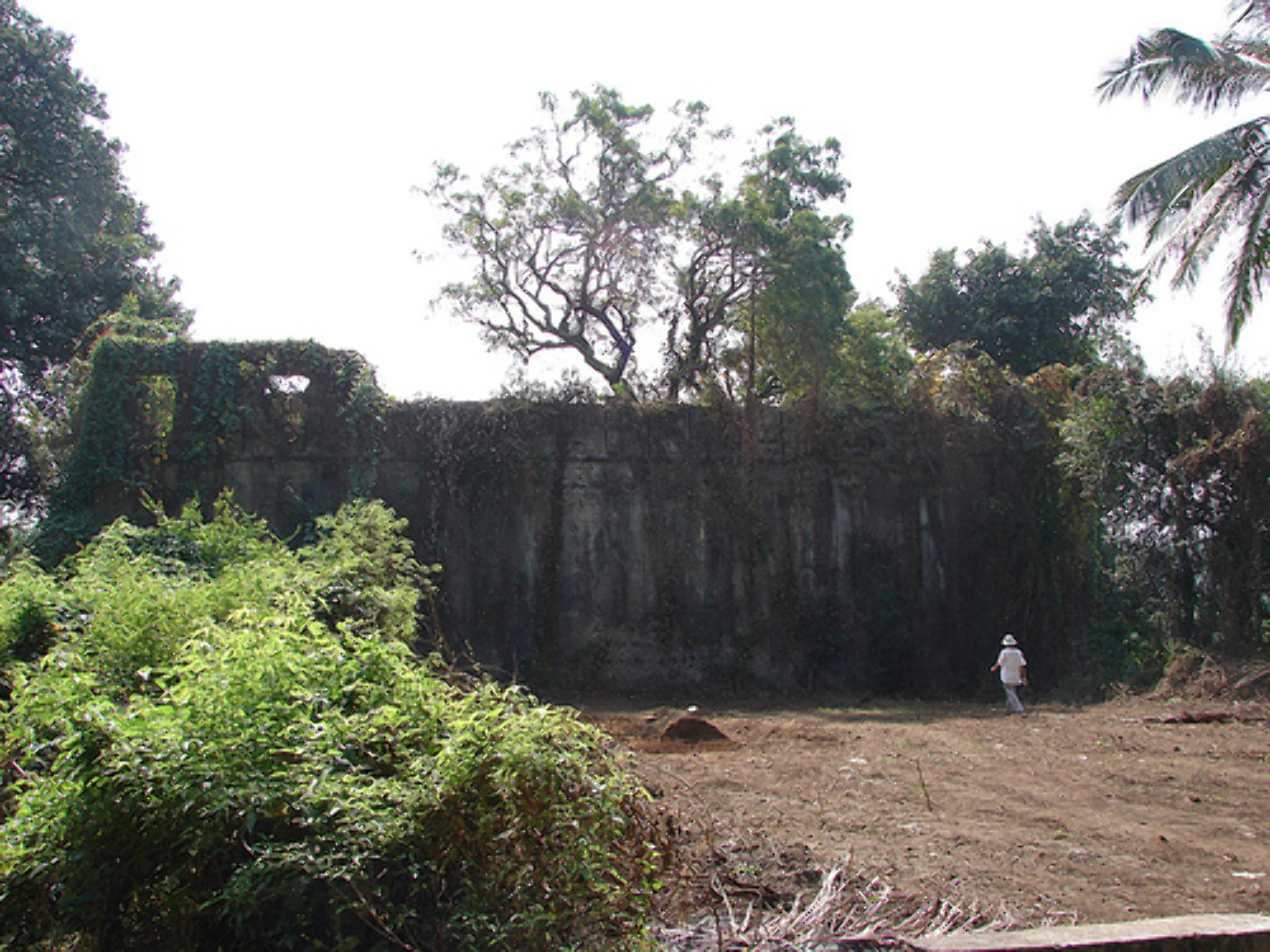
 The only way to enter is to climb up the fort walls about 20ft long. We do so by making use of the niches in the wall, and enter the small square openings in the bastion walls. There are 8 such small openings/entrances which can be used to access the fort during both high & low tides. At the western end of the of the fort we see a wall that separates a small part of the fort. The door used to exist but now in place one finds only a broken arch. On the left we can find a fresh water tank. The broken arch leads us into the balekilla which is like a huge watch tower 2 storeyed, but completely open and ruined. The walls on the left and right run narrow from east to west. They have huge windows on both the levels. Ruzbeh tries his stunt and climbs onto one of the upper windows. After taking a few photos, we descend back the fort walls and then reach Kelve village which is about 10min walk away from the fort.
 2 bastions. The one on the left is small and the western walls falls into somebody's private property. The bastion on the right is a huge one with 2 entrances. Both the entrances have wooden frames. There is a small church installed into the wall near the doors with the statues ofMother Mary clad in a sari holding baby Jesus. This church has been constructed in year 2002. We could not enter the fort cause of wild undergrowth inside. We return back to the road and move on keeping the bastion wall on the left. We reach an intersection, were the road to the left leads into Arnala village, on the right the road goes across the newly constructed bridge to Danda village. We move towards the left following the bastion wall which at the intersection falls into the customs office compound. The wall breaks of here. This area has been encroached by the village folk.
 Gadeshwar Prasanna”. However, we can find many other deities also inside such as Saibaba, Ganesh, Ekavira Devi, a small temple next to it dedicated to Lord Kartikeya (brother of lord Ganpati) and a yagna kund. This was quite unusual as one does not find as many temples of lord Kartikeya in Maharashtra as he is popular in the south. By the time we reached the temple there
 was not a soul there other than us. The atmosphere around is eternal bliss and we enjoyed spending some time there. We then moved on and reached the eastern main entrance with two huge bastions. The entrance is broken without any doors. We go inside towards the right and then turn left, climb up thru the bushes, pass between two broken fortifications of the balekilla and reach the inner area of the balekilla. Here we find a water tank well maintained and the water is potable. We now traverse the entire balekilla with extreme care as such areas are usually the home to several reptiles mainly snakes. This fort is also covered by a lot of cashew nut trees, though lesser than the earlier days when this region use to produce a lot of cashew nuts.
 We take the 5:30pm ferry across the creek and decide to make a quick tour of the fort to reach back in time for the last boat departing from the island at 7pm . The boat journey lasts for about 10min. We speedily walk towards the village and then reach the northern gate of the fort which is the main entrance. There are some inscriptions written here on the arch indicating that the fort was renovated by the Peshwa Bajirao 1. We move inside the entrance and check out the maha darwaja with huge dome and high circular ceilings. We turn left and enter the fort.
 huge and one can find staircases leading to hidden cellars in all the bastions. The middle bastion on the western wall is the biggest and has a hidden route from the top of the bastion to the western doorway. There is a Trimbakeshwar, a Bhavani Mata Temple and a Masjid inside the fort. Opposite the Trimbakeshwar temple is an octagonal shaped stepped well called as ‘Pushkarni'. At the eastern end of the fort we find a small temple like structure which houses the ‘padukas' of Swami Nityananda. There are two fresh water wells inside the fort, which provide
  drinking water to the villagers. From the southeastern bastion, we can spot a lone bastion at the south end of the island. This bastion is called as ‘Tehelni bastion' We traverse the entire fort by walking on the fort ramparts, descend from the northern side and walk across to the southern exit from where we reach the lone bastion at the southern end of the island. This bastion entrance is now buried in sand therefore one has to take hold of the strong roots of the trees which are growing inside the bastion (on the eastern side) and climb up the wall and enter thru the bastion windows. There is nothing inside except for a lot of sand and rubble. Ruzbeh again does a stunt and climbs up the bastion. Thanks to his height he is able to do so. I do not attempt purely due to time factor as we are already getting late. Ruzbeh descends quickly and we sprint our way back to the boat point from where we take the 6:30pm ferry and reach Arnala. Walking thru the village we reach the town bus stand from where we take a bus to Virar. We take the 8pm train and reach home by 9:30pm , thus bringing to an end another major expedition.
Saturday, February 21, 2015
Palghar- Neighbouring Beauty
From Wikipedia, the free encyclopedia


| Palghar | |
|---|---|
| City | |

Palghar
| |
| Coordinates: 19.69°N 72.76°ECoordinates: 19.69°N 72.76°E | |
| Country | |
| State | Maharashtra |
| District | Palghar |
| Government | |
| • Type | Municipal Council |
| • Body | Palghar Municipal Council (PMC) |
| • Member of Parliament | Mr. Chintamani Wanga |
| • MLA | Ghoda Krushna Arjun (Shiv Sena) |
| Elevation | 7 m (23 ft) |
| Population (2013) | |
| • Total | 550,166 (for Taluka) |
| Languages | |
| • Official | Marathi |
| Time zone | IST (UTC+5:30) |
| PIN | 401404 |
| Telephone code | 02525 |
| Vehicle registration | MH-48, MH-04 |

Palghar pronunciation (help·info)(Marathi: पालघर) is a town and a Municipal Council located about 87 kilometres north off Mumbai. Palghar lies on the Western Line of the Mumbai Suburban Railway on the busy Mumbai-Ahmedabad rail corridor. It is the administrative capital of the newly formed Palghar district. The town is located around 35 kilometers north of Virar and about 20 kilometres west of the Mumbai-Ahmedabad National Highway (NH 8) exit at Manor, India. Palghar, which was until 31 July 2014 known as a distant suburb of Mumbai has been accorded the status of a district headquarters following the formation of the Palghar district on 1 August 2014. It is Maharashtra's 36th district. Palghar remains a popular weekend getaway town for Mumbaikars. It is also an emerging town with high growth prospects located within the periphery of the Mumbai Metropolitan Region.
Located nearly 40 kilomteres away from Virar, Palghar acts as an important residential, industrial and educational hub for villages surrounding the town. Various age groups of people travel from the surrounding villages for different job opportunities, education, business, shopping and health care facilities. Many villages are connected to Palghar via road & rail. The government provides State Transport Bus facility to access these villages. Various villages surrounding Palghar include Tarapur, Umroli, Kelva, Satpati, Shirgaon, Saphale and Sartodi.
Contents
[hide]Employment[edit]
The main occupation of the people of Palghar is employment in factories and farming. The land surrounding Palghar abounds in human resources - skilled and unskilled. Apart from the government promoted MIDC situated at Tarapur, Palghar is also home to a number of Industrial Townships where there are many small scale industries such as engineering, pharmaceutical, plastics, textile, notebook industries. Maharashtra's biggest fishing center, Satpati, is located around 8 kilometres from Palghar railway station. There are farms growing chickoos, coconuts, palm dotted all around villages around Palghar. Rice is grown on agricultural lands during the monsoon. A large part of the population commutes to Mumbai daily to make a living. Palghar along with Dahanu accounts 50% of nations Chickoo's produce. Government of Maharashtra has established Coconut research center and Farm in Palghar.
Demographics[edit]
http://www.censusindia.gov.in/pca/SearchDetails.aspx?Id=586499As of 2011 India census,[1] Palghar had a population of 68,930 Males constitute 36,523 i.e. 52.9% of the population and females 32,407 i.e. 47.1% of the population. Palghar has an average literacy rate of 77.52%, higher than the national average of 59.5%: male literacy is 81.2%, and female literacy is 73.35%. In Palghar, 11.8% of the population is under 6 years of age.
For a town its size, Palghar is surprisingly cosmopolitan. Being a border town between Gujarat and Maharashtra and being close to Mumbai, it has a good percentage of population of people from other parts of country besides Maharashtra and Gujarat like Rajasthan, Kerala and North India. Most of the rich landlords of Palghar made their money trading grass to the dairies in Mumbai. Grass trading is a major occupation of many families in Palghar. The town is also close to an industrial complex, located at Boisar and India's first nuclear power plant, located at Tarapur.
Industrialization is gradually changing the face of Palghar. The town is getting a make-over of sorts due to Industrialization. Palghar's youth is getting employment in the small scale and medium scale industries coming up in and around the area. In the olden days agriculture was one of the main source of livelihood, but industrialization has opened up new avenues for them. With space & infrastructure constraints in Mumbai proper, Vasai, Boisar - Palghar proves to be the leading avenue in Western suburbs for setting up new industry / expansion purposes. Permissions are available fast.
Transportation[edit]
Palghar is well connected via road and rail transport. Palghar acts as a divisional head of MSRTC Maharashtra State Road Transport Corporation. MSRTC provides direct connectivity to several towns across Maharashtra including Miraj, Pune, Vaduj, Thane, Bhiwandi, Aurangabad, Ahmednagar,Kalyan,Alibag,Nandurbar,Bhusaval, Shirdi, Nashik etc. from Palghar.
Palghar is an important railway station on the Western Railway line of Mumbai Suburban Railway. Along with Shuttle/Memu/EMU(Local trains) services, many long distance trains also stop here.
Residential[edit]
Palghar is spread across a number of villages which has a number of residential colonies, housing complexes, independent housing units and cooperative housing societies. With real estate prices soaring in the area, satellite towns like Manor, India and Devkhop are being considered as affordable residential locations for the working population in the region.
Education[edit]
The Town has a number of Schools and Colleges. In the past few years, a number of construction projects have sprouted in the region. There is tremendous scope to set up new schools & colleges for increasing staying population.
Schools[edit]
Marathi schools[edit]
- Aryan high school
- Bhagini Samaj Vidyamandir
- Jeevan Vikas Shikshan Sanstha's Shri S.T. Kadam Vidyalaya
English schools[edit]
- Anand Ashram English High School
- Twinkle star English High school
- Kenam English High School
- Holy Spirit High School
- Sacred Heart High School
- Sundaram Central School (CBSE Board)
- Jawahar Navoday Vidyalaya (CBSE Board)
- Aryan English Medium
- Sir J.P. International School (ICSE Board)
- Bhagini Samaj Vidyamandir (Semi English)
- St. John's International School (CBSE Board)
- Surya Valley School
Hindi schools[edit]
- Bhavani Vidya Niketan Hindi High School
Gujarati schools[edit]
- Aryan High School
Colleges[edit]
- Sonopant Dandekar Shikshan Mandali's R.H.Save Arts, C.J.Bhanushali Commerce & B.A.Dandekar Science Jr. College (better known as SDSM College or Dandekar College)
- Sonopant Dandekar Shikshan Mandali's S.Dandekar Arts, V.S.Apte Commerece & M.H.Mehta Science Sr. College (better known as SDSM College or Dandekar College)
- National College Palghar
- St. John College of Engineering and Technology (SJCET)
- St. John Institute of Pharmacy and Research (SJIPR)
- St. John Institute of Management and Research (SJIMR)
- St.John Institute of Hospitality & Catering Technology (SJIHCT)
- Jeevan Vikas Shikshan Sanstha's Shri S.T.Kadam Mahavidyalaya (Marathi Medium)
- Yeshwantrao Chaphekar Vidya Sankul
- SNDT Women's College Palghar - proposed.
- Dr. M.L. Dhawale Memorial Homeopathic Institute
- Holy spirit Jr. college
- Government I.T.I.(Tribal) Palghar
Tourist Attractions[edit]
The famous Kelva Beach is just 13 km. by road. People from Mumbai & suburbs arrive on Sunday to enjoy the beach. Adjacent to the beach is the a temple dedicated to the Goddess Shitla Devi. One can reach the beach also by railway by alighting at Kelve Road Station just before Palghar. During the monsoons, the eastern hills of Palghar is home to several waterfalls. The hills are a favorite weekend hangout for locals and tourists from Mumbai. The little known Mahim beach is located just 7 kilometers from Palghar. It is a pristine stretch of beach located adjacent to the Kelve beach, separated only by a shallow estuary. Five kilometers from the town is another tourist attraction known as the Devkhop lake. The Shirgaon Fort is also accessible from Palghar. It is in fairly good condition and is next to a beach. The Manor Dam, located in Manor, India offers a picturesque panoramic view for day-trippers from Mumbai.
Miscellaneous[edit]
Palghar has many hospitals. Some are specialised for women's care while others treat all types of patients. There are sonography centres along with X-ray facility. The government primary health centre also caters to all patients free of charge. There are ambulance services for taking the patients to referral hospitals. Kanta Hospital blood storage centre provides blood to other hospitals in emergency and whenever required for delivery or surgery. There is a medical association of the doctors in and around Palghar which holds CME programmes to keep abreast with new developments in medicine. For complex treatment/surgery, there is no medical infrastructure in the region. There is tremendous scope to set up new hospitals in the region.
Hospitals[edit]
- Rural Hospital
- Dr. M.L. Dhawale Memorial Homeopathic Hospital
- Palghar Medical Center
- Sharada Hospital
- Philia Hospital
- Dhada Hospital
- Kanta Hospital (Dr Chawhan Rajendra's Maternity Home)
- Palghar Nursing Home
- Vaishali Nursing Home
- Ganesh Hospital (Orthopedic)
- Saikrupa hospital
- Prashanu maternity home
- Nanivadekar Hospital
- Palghar health unit
Major industries[edit]
Palghar has a number of prominent industries such as Welspun, Macleods,Dales Remedies, Fredun Pharmaceuticals Ltd, Pharma's first unit, Durian,Prime notebook, Sundaram Notebook, Jayant Printery, Ginza Industries Ltd, R&S Electronics, Ebco, EU-Medicaments, Raghuvanshi Exports, Abby Lighting, Astamed Healthcare (I) Pvt. Ltd., Fashion Forecast (India), Rapid Valves, Kamal Containers, Thakkar & Sons, Nirali Sinks, Vinod Cookware, Macro Bars And Wires (India), Austenitic Steels etc. Along with industries, Palghar has a number of industrial townships, prominent ones being Genesis Industrial Township and Dewan & Sons.
Newspapers[edit]
Saptahik Tarun Palghar (Marathi Weekly News Paper)[]
- Palghar Mitra (Marathi Paper weekly)
- Palghar Nagrik (marathi paper weekly)
- Navyug Palghar (Marathi Paper weekly)
- Rajmat Dut (Marathi Paper weekly)
- Palghar Times (Marathi Paper weekly)
- Vartahar Naradvaani (Marathi Paper weekly)
- Palghar Samachar (Gujarati Paper Weekly)
- Palghar Ki Awaaz (Hindi Paper weekly)
- Palghar Dahanu Jagruti(Marathi Paper Weekly))
- UDHYOG MANTRA,Technical news paper,Industry(English,Monthly)
Palghar nav mitra (Marathi paper weekly)


Palghar
Palghar
Palghar (Marathi: पालघर) is a city and a Municipal Council in Thane district in Maharashtra. Situated about 87 kilometres from Mumbai, it is a part of the Mumbai Suburban Rail network which extends up to Dahanu and lies on the Mumbai- Ahmedabad rail route. Palghar is the next major junction after Virar on the Western Railway and is also accessible by the Mumbai-Ahmedabad National Highway (NH 8). The town is complete with everything necessary for a comfortable life including shopping centres, schools, colleges, cinemas, restaurants and hospitals. The environment is luscious and pollution-free which creates a tranquil ambience and ideal atmosphere to start any activity.
Fast Facts
State: Maharashtra
District: Thane
Famous for/as: City
Languages: Marathi, Hindi, English
Best Season: Oct – Mar
Weather: Summer 23-37°C, Winter 16-26°C
Altitude: 7 m
Pincode: 401404
STD code: 02525
http://www.mustseeindia.com/Palghar-map/map
the Distance from Mumbai to Palghar is 121 km.And Drive from Mumbai to Palghar takes about 2 hours by car.
Start from Nariman Point and cross Mumbai Central, Mahalaxmi, Dadar, Malad
Sativali 41 km Continue on NH 8
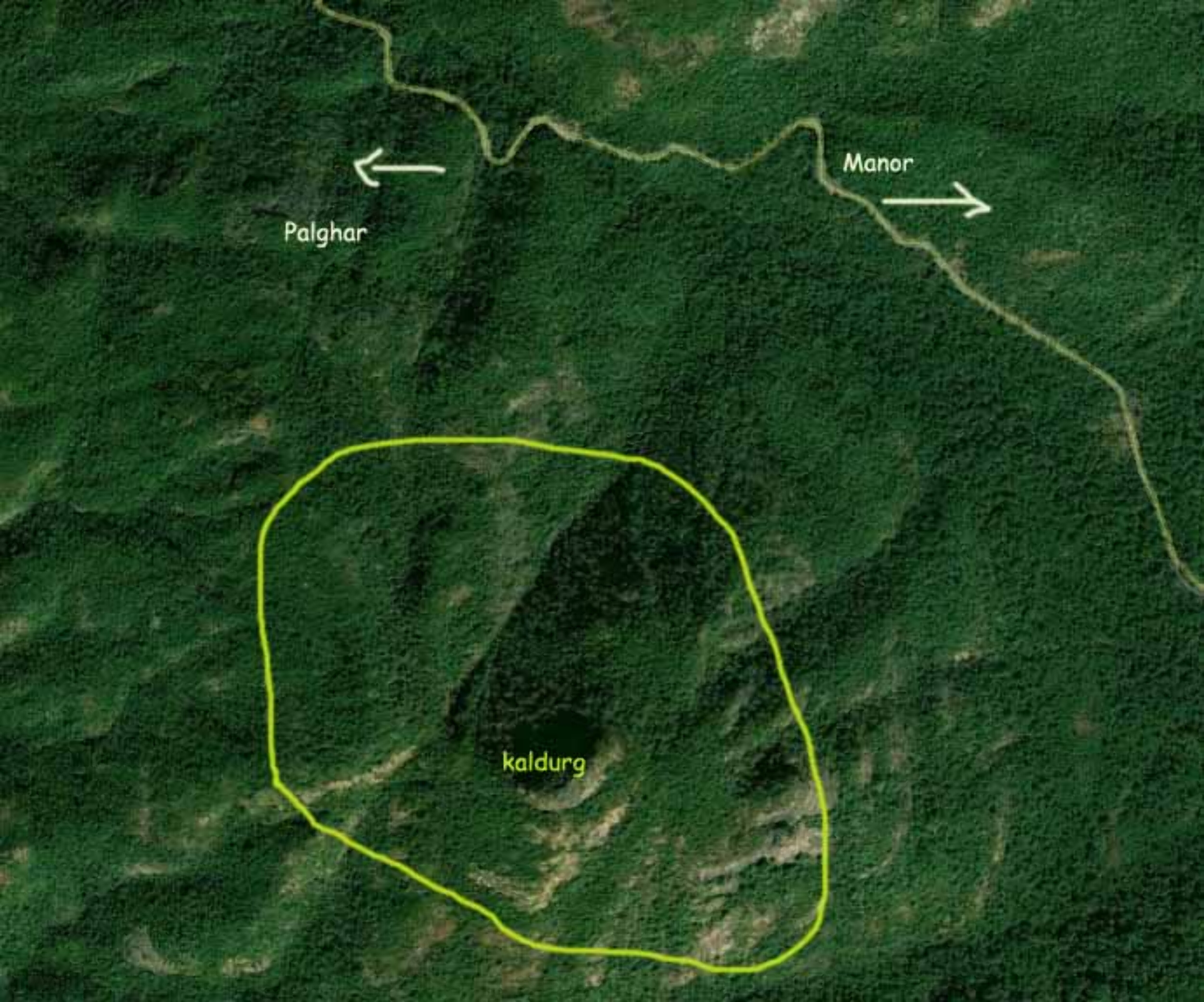
Manor 18 km SH-3
At Manor, Turn Right on SH 3 via Netali – Palghar

Palghar, a municipal area in the thane district of Maharashtra state in
India, is presently an industrial city with all facets of a growing
cosmopolitan. This is situated in the ardent Konkan coast, but mostly
busy with cities growing demands and industrialization. The city is in
the border of the state of Gujarat and is close to Tarapur, location of
India’s first nuclear power plant.
The Palghar has a mixed community with many landlords as well
as common workers. Trading of grass is the chief employment of many
families in Palghar. Most of the landlords got their wealth through the
grass to dairies in Mumbai. With the industrialization in full swing
people have shifted their attention to working in industries and big
factories. Palghar is home to job aspirants from many states all over
India. It is thriving with the concept of unity in diversity with people
from many cultures, caste and creed.
Palghar is one of the major city in the Mumbai suburban rail
network. Palghar is the base point for tourists to many nearby tourist
destinations. Palghar offer fine accommodation facilities for the
tourists reaching here. Many luxurious resorts have come up here
offering high class facilities and greater variety of cuisines.
Palghar’s night life is vibrant with many street fast food services and
film theaters.
Palghar is still greenish with farms with palm trees, coconuts
and rice cultivation. Blessed with many serene lakes, soft sandy
beaches, historical forts, and unique temples like Ram Mandir, Palghar
attracts many tourists to its lap.
Shirgaon Fort

Shirgaon Fort is located at one side of Shirgaon beach. The fort was
used by great Maratha King Chathrapathi Shivaji as a place to keep a
watch on enemies coming through Arabian Sea. The ancient fort is in
ruins now.
 The fort is a tourist place to bring back the memory of Maratha
culture and the golden days of Maratha Rule in this region. The views
of the vast Arabian Sea and the expanse of greenish palm farms from the
Shirgaon fort are really breathtaking.
 Beachs in Palghar
Palgar boast of with holding the three spectacular beaches- Shirgaon,
Beachs in Palghar
Palgar boast of with holding the three spectacular beaches- Shirgaon,
Satpati and Kelva. The beaches are indeed an ideal weekend getaway for
Mumbaikars and they can expect to have a number of beach games, accompanied
with their family and friends.
Lets know a brief about the three cited coastline
Shirgaon Beach
Situated about 11 kms from the town Shirajon offers the impressive view of
the Arabian Sea and its nearby Shirgaon village. The place also has the
remains of an 18th century fort that is no more under the catalog of
attraction. Visitors can relax on the beach, have fun with playing cricket
or can interact with the fisher-folk, dwelling on the way. At time boating
is highly opted by the enthusiast water-sport lovers.
Satpati Beach
This beach is not busy like the other two and is often called as the sleepy
hamlet with many palm trees. It is 13 kms away from the main town and very
close to Shirgaon beach. The only activity here is to watch the fishermen’s
boats with their colorful flags, which swings on with the motion of air and
boat.
Kelva Beach

 Kelva Beach is the most beautiful location for vacations near Palghar.
It has the largest stretch of beautiful cost line of Arabian Sea in
Thane District. The unique feature of the beach is the abundance of the
Suru trees and it is the most sought weekend destination sought by
local populace, domestic visitors from Mumbai and also from other parts
of state.
Kelva fort and Sheetala Devi temple located at the lakeside add
the attraction of the Kelva beach. There are many resorts and
luxurious hotels for the comfortable stay of tourists.
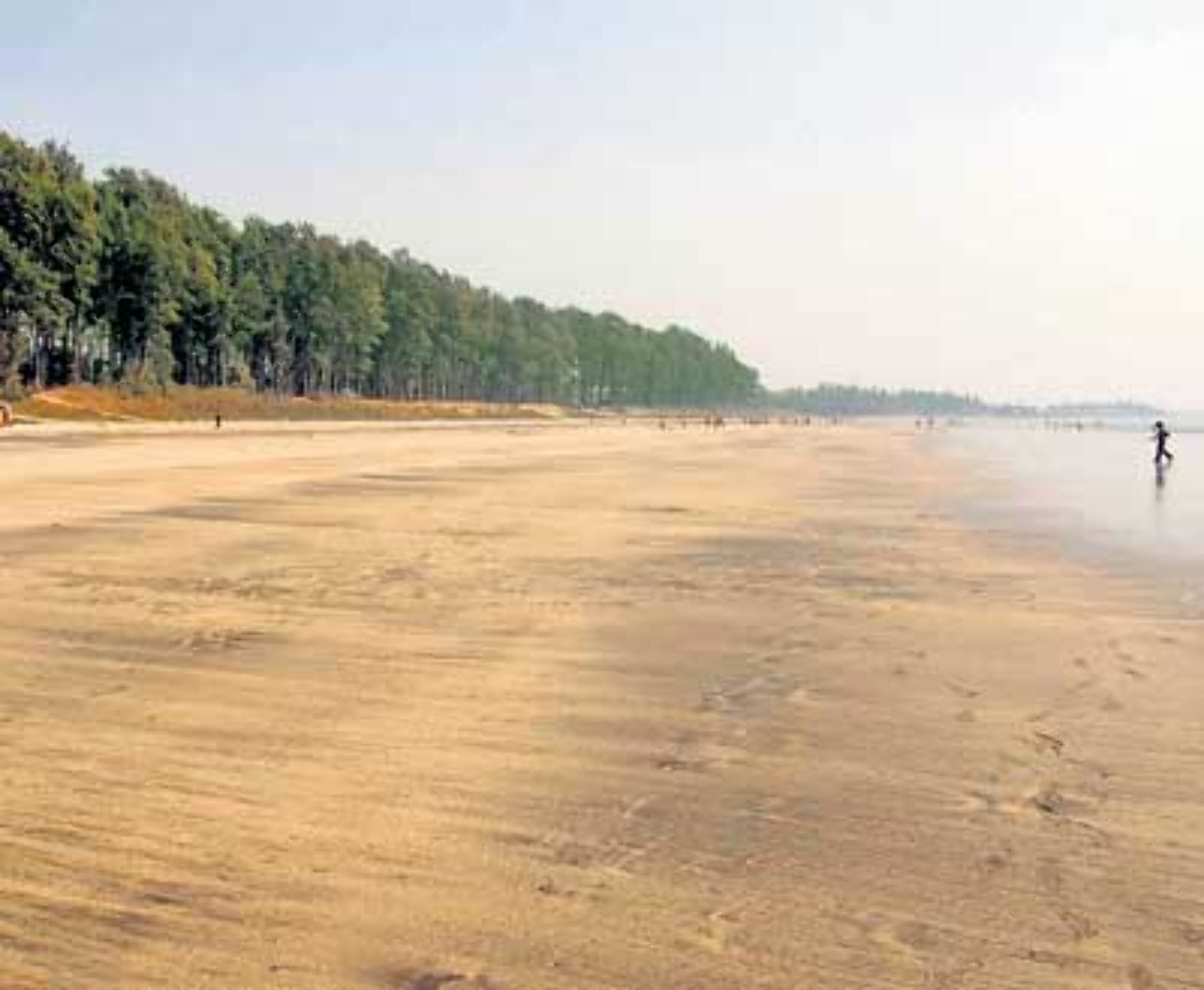
A few thousand Suru trees stand sentinel on Kelve
beach, the largest stretch (about 7 km) of coastline in the region. At
it’s southern end is the Kelve Fort. The Kelve fort is virtually
inaccessible at high tide, which is when it looks most romantic. At low
tide the features of the fort are more discernible. But the climb up the
walls is clearly not for the lily-livered! Boats are available until
sunset for hoisting the adventurous to th roof top via a pulley. Once
ther you find the fort full of undergrowth and appears derelict. While
in Kelva, visit the Shitladevi mandir on the beach. If you still have energy left, head to Kelva dam (10 kms.) Try stop off at Mahim beach
6 kms out on the way to Kelva, which is good for a cursory stroll. But
make sure that Kelve is where you spend most of your morning.
Motivator! – Kelve beach had the most number of visitors on the 31st
of Dec. A crowd of more then 10,000 celebrated the new year here.
When to visit the beaches in Palghar
The best time to visit the Palghar beach in Maharashtra is from April to
May. Besides, visitors can enjoy the scenic beach beauty during Monsoon i.e
from June to September.
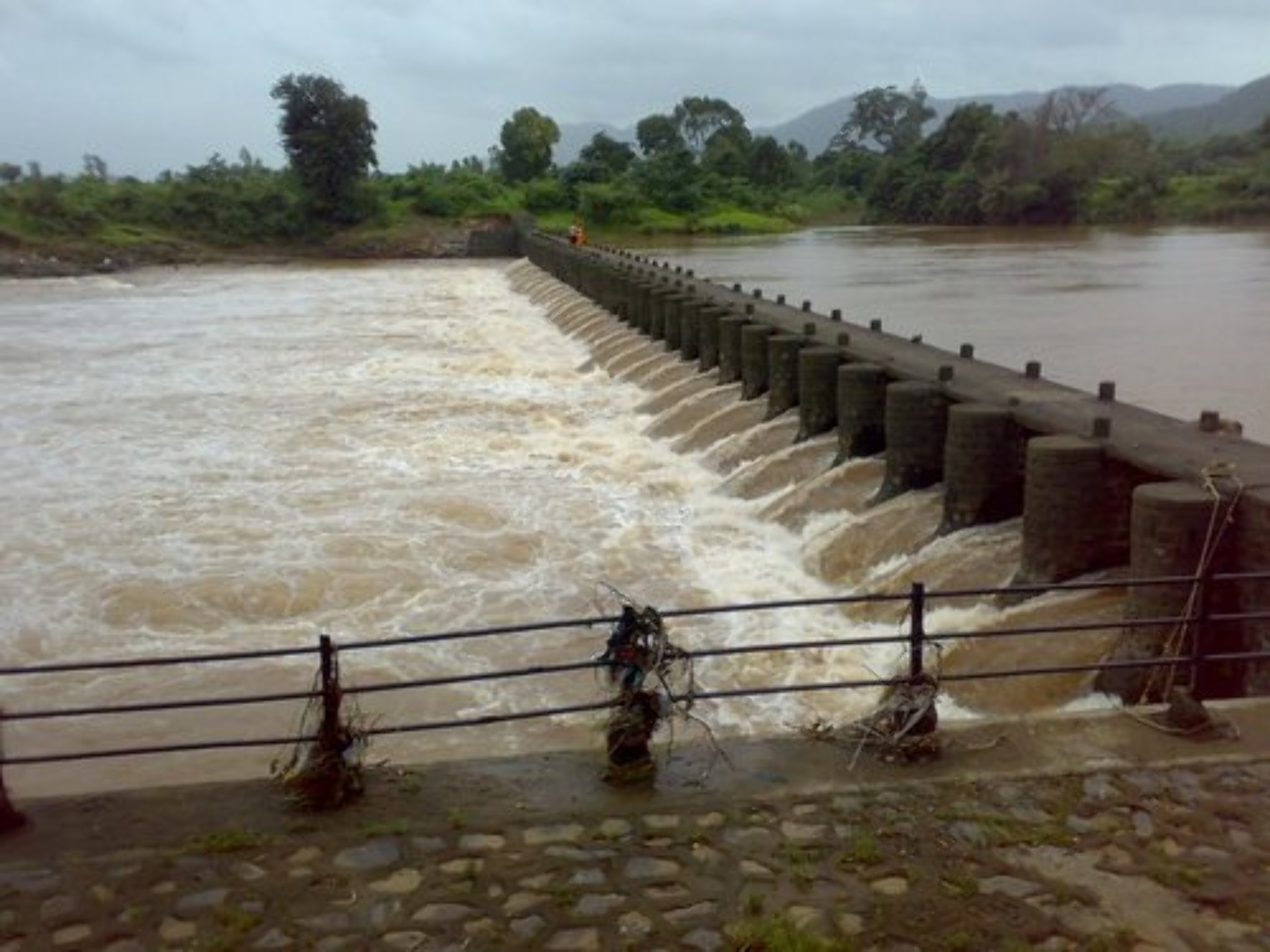
Kelva dam
Kelva dam, located at picturesque surroundings, was constructed many
years back as a source for the irrigation in the grass farming of
Palghar. This has been a storage dam of the water in the Kelva dam. The
dam site offer cool and secluded place for evening tours. During
weekends many tourists visit this place. A garden located nearby add the
attraction of the dam site.
Devkop
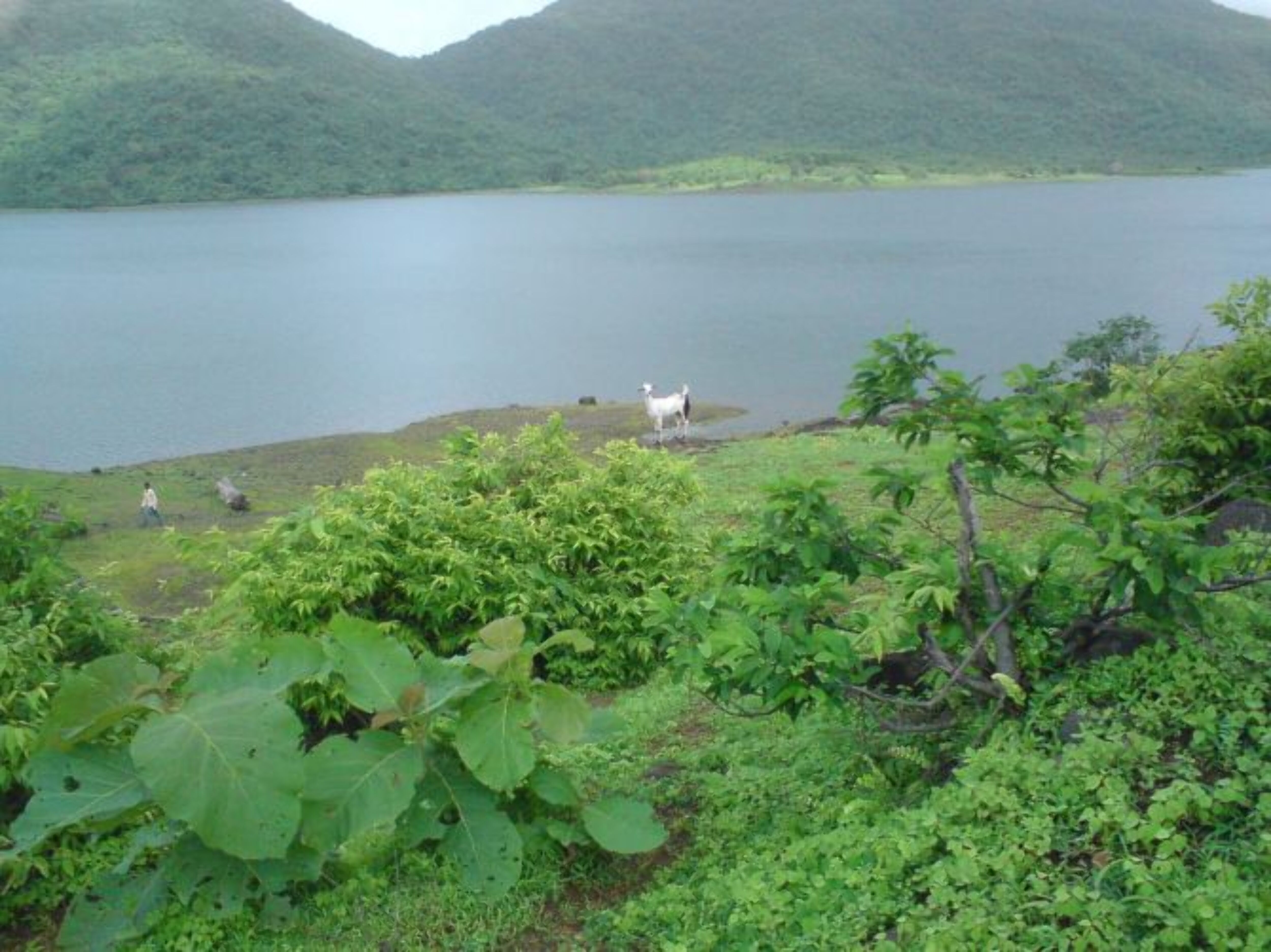 The hidden beauty Devkop in the hills attracts photographs and picnickers
during the monsoon season. It is situated 12 kms away from Palghar beach and
can be easily accessed by means of local transport facilities. A 10 min trek
along the path offers the several dots of straw huts on one side and the
fields on the other side. Visitors can halt for a while on the vicinity of
the Devkop Lake, surrounded by hills on three sides and casting stunning
reflection on a clear sunny day.
Kaldurg (Palghar)
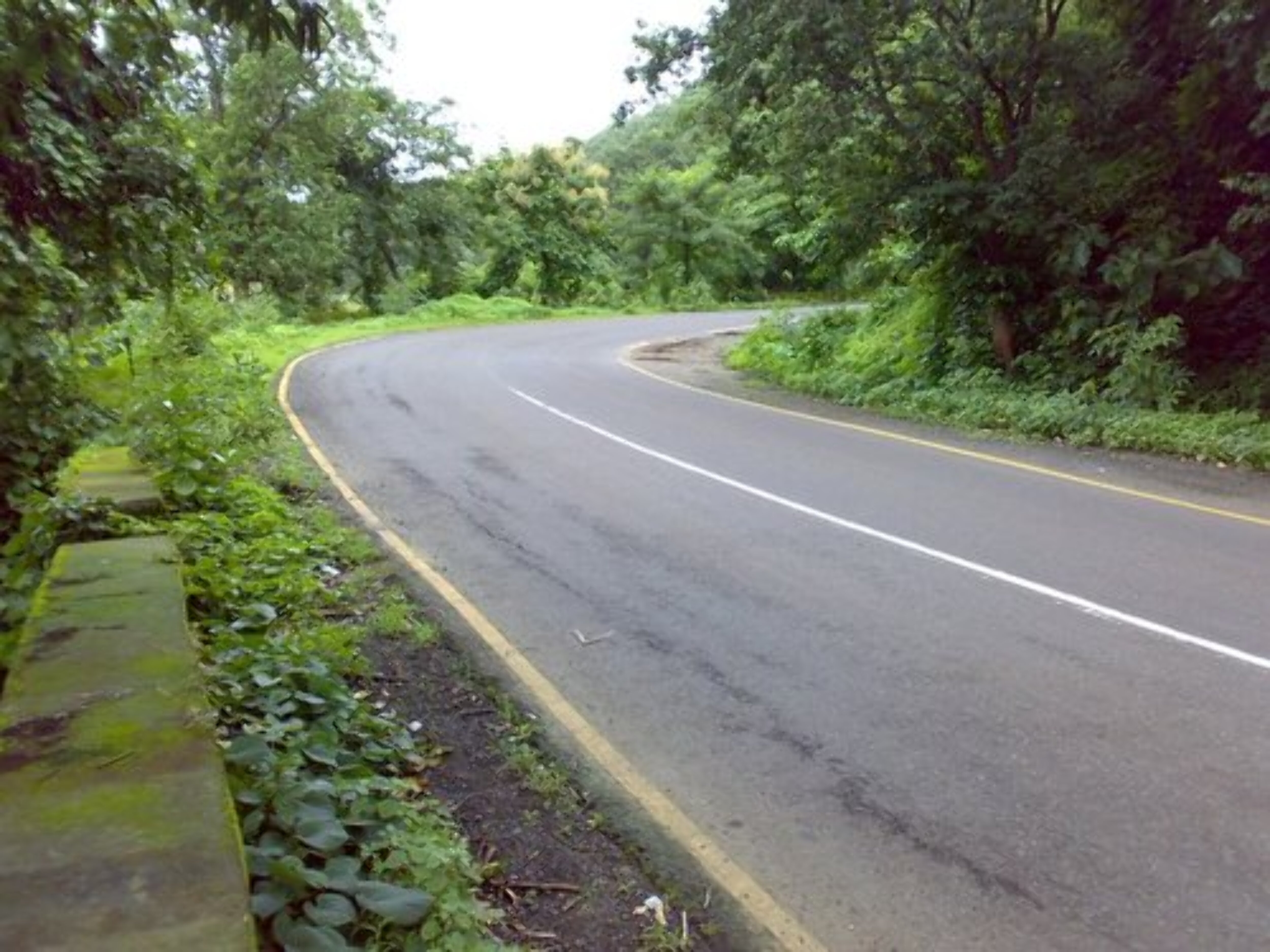
 Kaldurg is very rare trek and hence the route is very dull and has
lots of spots where long grasses are there. You need to be careful at
such spots otherwise you can get lost. After climbing from the forest
for half an hour, we reach a flat small area of black basalt rocks. From
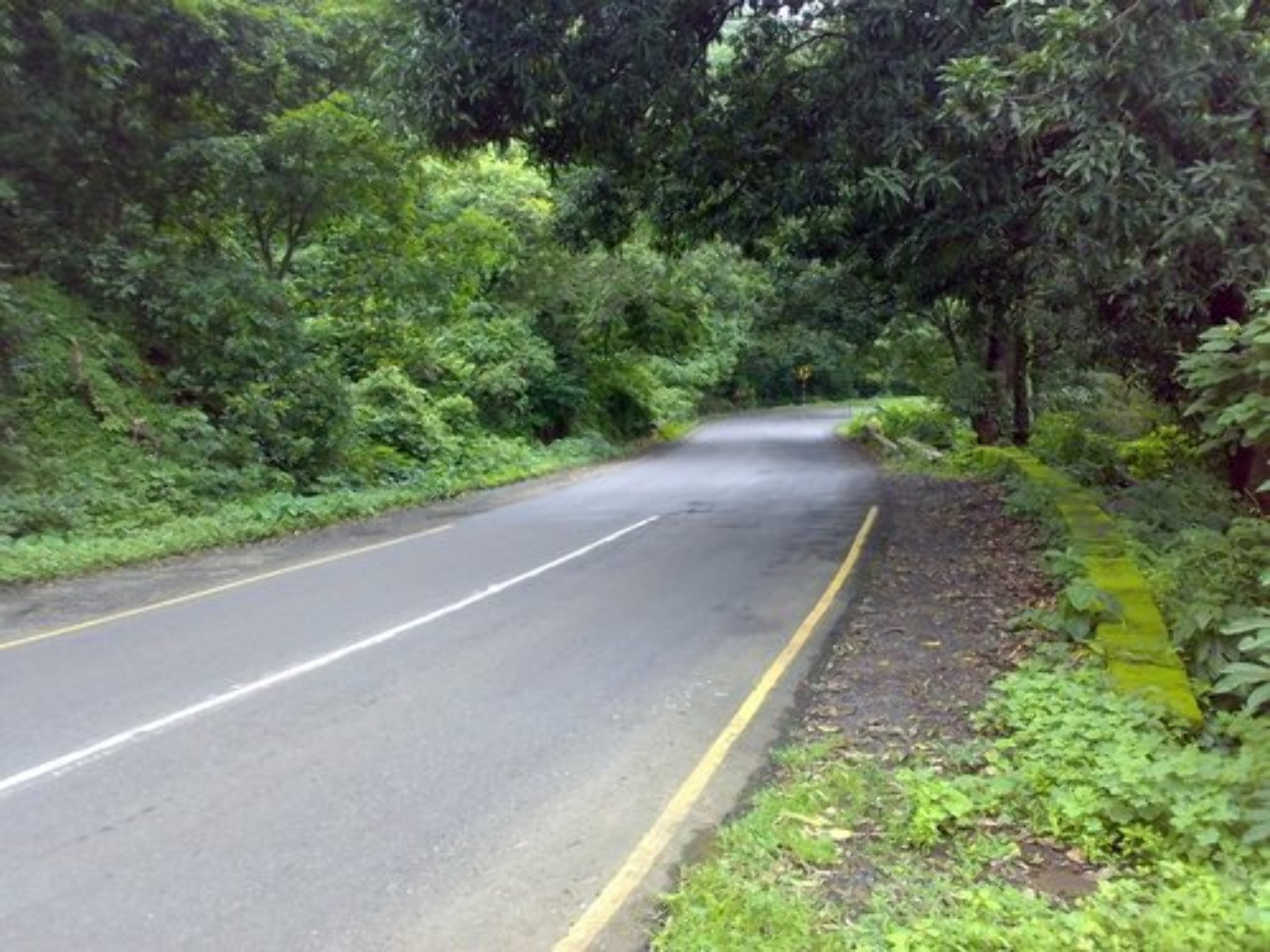
here, face yourself to the Palghar – Manor road, and on the right side,
you can see the Kaldurg’s top. Go ahead on right side and then another
45 mins trek will take you to the top.
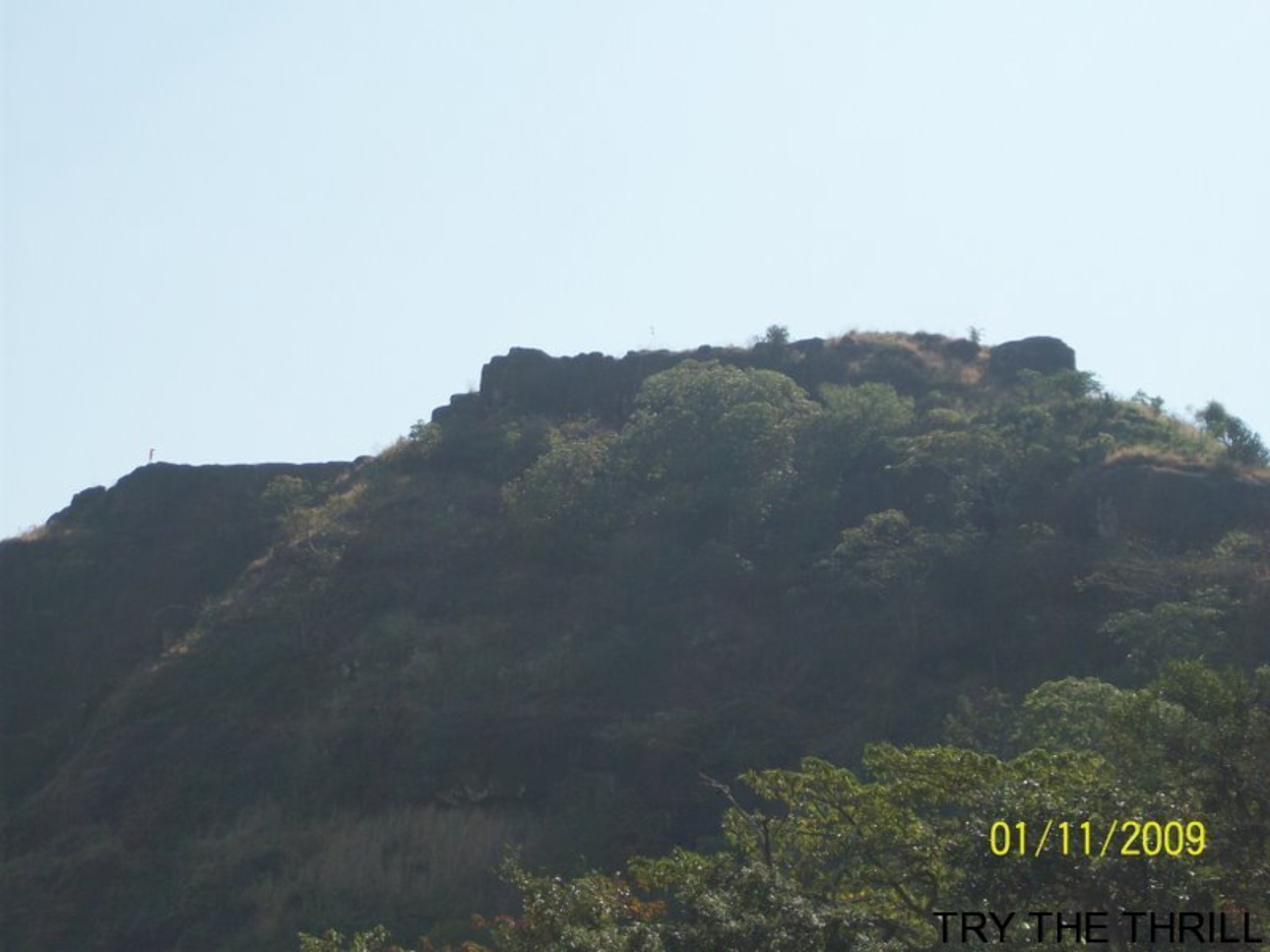
 Kaldurg trek is good option for those who are willing to do small half
day trek nearby Mumbai city. Even its good for first timers. It will be double fun to do it in monsoon. Its really a
cool place with lots of running waterfalls in monsoon season.
Waghoba Waterfall
This is one of the natual attraction in rainy season.People enjoy showers of water in holidays. It is approximately 8 k.m. from Palghar station.
Maswan Dam & Village
 Maswan is beautiful village having great culture. Though the village
population is around 2000, the village has supirior infrastructure (i.e
Water, road, communication etc.). The village is surrounded by surya
river on one side and other side by hills. The climate here is extreme
as it is part of upper konkan.
Village Population : 455, Population residing outside village : 148.
Maswan is situated on the banks of the Surya river. It has a school which provied education till 10th standard. Maswan also has a primary health centre and ashram school. The village is surrounded by adivasi colonies. A neighbouring adivasi village called Kokaner has hot water springs and a Shankar mandir. Likewise, Maswan also has an old Hanuman and Gavdevi mandir.
Maswan gets heavily flooded during the monsoons each year due to its proximity to the dams. The water levels usually rise upto 12 feet and cause large scale destruction to property. The water supplied in the village is also not fit for drinking and has to be extensively boiled. The weather also gets unbearably hot and humid in the summer season. However, Maswan is a visual delight for its scenery and locales.
Palghar
Palghar (Marathi: पालघर) is a city and a Municipal Council in Thane district in Maharashtra. Situated about 87 kilometres from Mumbai, it is a part of the Mumbai Suburban Rail network which extends up to Dahanu and lies on the Mumbai- Ahmedabad rail route. Palghar is the next major junction after Virar on the Western Railway and is also accessible by the Mumbai-Ahmedabad National Highway (NH 8). The town is complete with everything necessary for a comfortable life including shopping centres, schools, colleges, cinemas, restaurants and hospitals. The environment is luscious and pollution-free which creates a tranquil ambience and ideal atmosphere to start any activity.
Fast Facts
State: Maharashtra
District: Thane
Famous for/as: City
Languages: Marathi, Hindi, English
Best Season: Oct – Mar
Weather: Summer 23-37°C, Winter 16-26°C
Altitude: 7 m
Pincode: 401404
STD code: 02525
District: Thane
Famous for/as: City
Languages: Marathi, Hindi, English
Best Season: Oct – Mar
Weather: Summer 23-37°C, Winter 16-26°C
Altitude: 7 m
Pincode: 401404
STD code: 02525
http://www.mustseeindia.com/Palghar-map/map
the Distance from Mumbai to Palghar is 121 km.And Drive from Mumbai to Palghar takes about 2 hours by car.
Start from Nariman Point and cross Mumbai Central, Mahalaxmi, Dadar, Malad
Sativali 41 km Continue on NH 8
Manor 18 km SH-3
At Manor, Turn Right on SH 3 via Netali – Palghar
Start from Nariman Point and cross Mumbai Central, Mahalaxmi, Dadar, Malad
Sativali 41 km Continue on NH 8
Manor 18 km SH-3
At Manor, Turn Right on SH 3 via Netali – Palghar
Palghar, a municipal area in the thane district of Maharashtra state in
India, is presently an industrial city with all facets of a growing
cosmopolitan. This is situated in the ardent Konkan coast, but mostly
busy with cities growing demands and industrialization. The city is in
the border of the state of Gujarat and is close to Tarapur, location of
India’s first nuclear power plant.
The Palghar has a mixed community with many landlords as well
as common workers. Trading of grass is the chief employment of many
families in Palghar. Most of the landlords got their wealth through the
grass to dairies in Mumbai. With the industrialization in full swing
people have shifted their attention to working in industries and big
factories. Palghar is home to job aspirants from many states all over
India. It is thriving with the concept of unity in diversity with people
from many cultures, caste and creed.
Palghar is one of the major city in the Mumbai suburban rail
network. Palghar is the base point for tourists to many nearby tourist
destinations. Palghar offer fine accommodation facilities for the
tourists reaching here. Many luxurious resorts have come up here
offering high class facilities and greater variety of cuisines.
Palghar’s night life is vibrant with many street fast food services and
film theaters.
Palghar is still greenish with farms with palm trees, coconuts
and rice cultivation. Blessed with many serene lakes, soft sandy
beaches, historical forts, and unique temples like Ram Mandir, Palghar
attracts many tourists to its lap.
and rice cultivation. Blessed with many serene lakes, soft sandy
beaches, historical forts, and unique temples like Ram Mandir, Palghar
attracts many tourists to its lap.
Shirgaon Fort
Shirgaon Fort is located at one side of Shirgaon beach. The fort was
used by great Maratha King Chathrapathi Shivaji as a place to keep a
watch on enemies coming through Arabian Sea. The ancient fort is in
ruins now.
Shirgaon Fort is located at one side of Shirgaon beach. The fort was
used by great Maratha King Chathrapathi Shivaji as a place to keep a
watch on enemies coming through Arabian Sea. The ancient fort is in
ruins now.
The fort is a tourist place to bring back the memory of Maratha
culture and the golden days of Maratha Rule in this region. The views
of the vast Arabian Sea and the expanse of greenish palm farms from the
Shirgaon fort are really breathtaking.
culture and the golden days of Maratha Rule in this region. The views
of the vast Arabian Sea and the expanse of greenish palm farms from the
Shirgaon fort are really breathtaking.
Beachs in Palghar
Palgar boast of with holding the three spectacular beaches- Shirgaon,
Satpati and Kelva. The beaches are indeed an ideal weekend getaway for
Mumbaikars and they can expect to have a number of beach games, accompanied
with their family and friends.
Satpati and Kelva. The beaches are indeed an ideal weekend getaway for
Mumbaikars and they can expect to have a number of beach games, accompanied
with their family and friends.
Lets know a brief about the three cited coastline
Shirgaon Beach
Situated about 11 kms from the town Shirajon offers the impressive view of
the Arabian Sea and its nearby Shirgaon village. The place also has the
remains of an 18th century fort that is no more under the catalog of
attraction. Visitors can relax on the beach, have fun with playing cricket
or can interact with the fisher-folk, dwelling on the way. At time boating
is highly opted by the enthusiast water-sport lovers.
Satpati Beach
This beach is not busy like the other two and is often called as the sleepy
hamlet with many palm trees. It is 13 kms away from the main town and very
close to Shirgaon beach. The only activity here is to watch the fishermen’s
boats with their colorful flags, which swings on with the motion of air and
boat.
Kelva Beach
Kelva Beach is the most beautiful location for vacations near Palghar.
It has the largest stretch of beautiful cost line of Arabian Sea in
Thane District. The unique feature of the beach is the abundance of the
Suru trees and it is the most sought weekend destination sought by
local populace, domestic visitors from Mumbai and also from other parts
of state.
It has the largest stretch of beautiful cost line of Arabian Sea in
Thane District. The unique feature of the beach is the abundance of the
Suru trees and it is the most sought weekend destination sought by
local populace, domestic visitors from Mumbai and also from other parts
of state.
Kelva fort and Sheetala Devi temple located at the lakeside add
the attraction of the Kelva beach. There are many resorts and
luxurious hotels for the comfortable stay of tourists.
A few thousand Suru trees stand sentinel on Kelve
beach, the largest stretch (about 7 km) of coastline in the region. At
it’s southern end is the Kelve Fort. The Kelve fort is virtually
inaccessible at high tide, which is when it looks most romantic. At low
tide the features of the fort are more discernible. But the climb up the
walls is clearly not for the lily-livered! Boats are available until
sunset for hoisting the adventurous to th roof top via a pulley. Once
ther you find the fort full of undergrowth and appears derelict. While
in Kelva, visit the Shitladevi mandir on the beach. If you still have energy left, head to Kelva dam (10 kms.) Try stop off at Mahim beach
6 kms out on the way to Kelva, which is good for a cursory stroll. But
make sure that Kelve is where you spend most of your morning.
Motivator! – Kelve beach had the most number of visitors on the 31st
of Dec. A crowd of more then 10,000 celebrated the new year here.
When to visit the beaches in Palghar
The best time to visit the Palghar beach in Maharashtra is from April to
May. Besides, visitors can enjoy the scenic beach beauty during Monsoon i.e
from June to September.
Kelva dam
Kelva dam, located at picturesque surroundings, was constructed many
years back as a source for the irrigation in the grass farming of
Palghar. This has been a storage dam of the water in the Kelva dam. The
dam site offer cool and secluded place for evening tours. During
weekends many tourists visit this place. A garden located nearby add the
attraction of the dam site.
Devkop
The hidden beauty Devkop in the hills attracts photographs and picnickers
during the monsoon season. It is situated 12 kms away from Palghar beach and
can be easily accessed by means of local transport facilities. A 10 min trek
along the path offers the several dots of straw huts on one side and the
fields on the other side. Visitors can halt for a while on the vicinity of
the Devkop Lake, surrounded by hills on three sides and casting stunning
reflection on a clear sunny day.
Kaldurg (Palghar)
Kaldurg is very rare trek and hence the route is very dull and has
lots of spots where long grasses are there. You need to be careful at
such spots otherwise you can get lost. After climbing from the forest
for half an hour, we reach a flat small area of black basalt rocks. From
here, face yourself to the Palghar – Manor road, and on the right side,
you can see the Kaldurg’s top. Go ahead on right side and then another
45 mins trek will take you to the top.
Kaldurg trek is good option for those who are willing to do small half
day trek nearby Mumbai city. Even its good for first timers. It will be double fun to do it in monsoon. Its really a
cool place with lots of running waterfalls in monsoon season.
day trek nearby Mumbai city. Even its good for first timers. It will be double fun to do it in monsoon. Its really a
cool place with lots of running waterfalls in monsoon season.
Waghoba Waterfall
This is one of the natual attraction in rainy season.People enjoy showers of water in holidays. It is approximately 8 k.m. from Palghar station.
Maswan Dam & Village
Maswan is beautiful village having great culture. Though the village
population is around 2000, the village has supirior infrastructure (i.e
Water, road, communication etc.). The village is surrounded by surya
river on one side and other side by hills. The climate here is extreme
as it is part of upper konkan.
population is around 2000, the village has supirior infrastructure (i.e
Water, road, communication etc.). The village is surrounded by surya
river on one side and other side by hills. The climate here is extreme
as it is part of upper konkan.
Village Population : 455, Population residing outside village : 148.
Maswan is situated on the banks of the Surya river. It has a school which provied education till 10th standard. Maswan also has a primary health centre and ashram school. The village is surrounded by adivasi colonies. A neighbouring adivasi village called Kokaner has hot water springs and a Shankar mandir. Likewise, Maswan also has an old Hanuman and Gavdevi mandir.
Maswan gets heavily flooded during the monsoons each year due to its proximity to the dams. The water levels usually rise upto 12 feet and cause large scale destruction to property. The water supplied in the village is also not fit for drinking and has to be extensively boiled. The weather also gets unbearably hot and humid in the summer season. However, Maswan is a visual delight for its scenery and locales.
Travel within city
Palghar is a township that is located in the Thane district in the
State of Maharashtra. Infrastructure is well developed and there are a
few good transport options that are available in the city.
Palghar is a township that is located in the Thane district in the
State of Maharashtra. Infrastructure is well developed and there are a
few good transport options that are available in the city.
State of Maharashtra. Infrastructure is well developed and there are a
few good transport options that are available in the city.
Railway Station
Palghar has a railway station that is connected well with trains and for
those who reach the station, there is easy access from the railway
station to the town center. There are auto rickshaws and taxis that are
available from the railway station. Some autos are metered and it is
advisable to ask or request using the meter before boarding.
Some of the local travel options include autos and buses.
Palghar has a railway station that is connected well with trains and for
those who reach the station, there is easy access from the railway
station to the town center. There are auto rickshaws and taxis that are
available from the railway station. Some autos are metered and it is
advisable to ask or request using the meter before boarding.
those who reach the station, there is easy access from the railway
station to the town center. There are auto rickshaws and taxis that are
available from the railway station. Some autos are metered and it is
advisable to ask or request using the meter before boarding.
Some of the local travel options include autos and buses.
Auto Rickshaw
Auto rickshaws are available from all parts of the town and they are the
quickest mode of transport. They may charge special night fare. Prices
are negotiable and it is advisable to be prepares for lengthy
negotiations during the night, when autos are rare to find.
Auto rickshaws are available from all parts of the town and they are the
quickest mode of transport. They may charge special night fare. Prices
are negotiable and it is advisable to be prepares for lengthy
negotiations during the night, when autos are rare to find.
quickest mode of transport. They may charge special night fare. Prices
are negotiable and it is advisable to be prepares for lengthy
negotiations during the night, when autos are rare to find.
Bus
Buses are cheap and connect most parts of town. Tickets cost around Rs
10 to 20. There are designated bus stops all over and buses are fairly
frequent.
Employment
The main occupation of the people of Palghar is employment in factories and farming. The land surrounding Palghar abounds in human resources – skilled and unskilled. Apart from the government promoted MIDC situated at Tarapur, Palghar is also home to a number of Industrial Townships where there are many small scale industries such as engineering, pharmaceutical, plastics, textile, notebook industries. Maharashtra’s biggest fishing center, Satpati, is located around 8 kilometres from Palghar railway station. There are farms growing chickoos, coconuts, palm dotted all around villages around Palghar. Rice is grown on agricultural lands during the monsoon. A large part of the population commutes to Mumbai daily to make a living.
Buses are cheap and connect most parts of town. Tickets cost around Rs
10 to 20. There are designated bus stops all over and buses are fairly
frequent.
Employment
10 to 20. There are designated bus stops all over and buses are fairly
frequent.
Employment
The main occupation of the people of Palghar is employment in factories and farming. The land surrounding Palghar abounds in human resources – skilled and unskilled. Apart from the government promoted MIDC situated at Tarapur, Palghar is also home to a number of Industrial Townships where there are many small scale industries such as engineering, pharmaceutical, plastics, textile, notebook industries. Maharashtra’s biggest fishing center, Satpati, is located around 8 kilometres from Palghar railway station. There are farms growing chickoos, coconuts, palm dotted all around villages around Palghar. Rice is grown on agricultural lands during the monsoon. A large part of the population commutes to Mumbai daily to make a living.
Demographics
As of 2001 India cencus,
Palghar had a population of 52,699. Males constitute 54% of the
population and females 46%. Palghar has an average literacy rate of 73%,
higher than the national average of 59.5%: male literacy is 78%, and
female literacy is 72%. In Palghar, 13% of the population is under 6
years of age.
For a town its size, Palghar is surprisingly cosmopolitan. Being a border town between Gujarat
and Maharashtra and being close to Mumbai, it has a good percentage of
population of people from other states besides Maharashtra like Gujarat,
Rajasthan, Kerala, Uttar Pradesh and Bihar. Most of the rich landlords
of Palghar made their money trading grass to the dairies in Mumbai.
Grass trading is a major occupation of many families in Palghar. The
town is also close to an industrial complex, located at Boisar and India’s first nuclear power plant, located at Tarapur.
Industrialization is gradually changing the face of Palghar. The town
is getting a make-over of sorts due to Industrialization. Palghar’s
youth are getting employment in the small scale and medium scale
industries coming up in and around the area. In the olden days
agriculture was one of the main source of livelihood, but
Industrialization has opened up new avenues for them.
As of 2001 India cencus,
Palghar had a population of 52,699. Males constitute 54% of the
population and females 46%. Palghar has an average literacy rate of 73%,
higher than the national average of 59.5%: male literacy is 78%, and
female literacy is 72%. In Palghar, 13% of the population is under 6
years of age.
Palghar had a population of 52,699. Males constitute 54% of the
population and females 46%. Palghar has an average literacy rate of 73%,
higher than the national average of 59.5%: male literacy is 78%, and
female literacy is 72%. In Palghar, 13% of the population is under 6
years of age.
For a town its size, Palghar is surprisingly cosmopolitan. Being a border town between Gujarat
and Maharashtra and being close to Mumbai, it has a good percentage of
population of people from other states besides Maharashtra like Gujarat,
Rajasthan, Kerala, Uttar Pradesh and Bihar. Most of the rich landlords
of Palghar made their money trading grass to the dairies in Mumbai.
Grass trading is a major occupation of many families in Palghar. The
town is also close to an industrial complex, located at Boisar and India’s first nuclear power plant, located at Tarapur.
Industrialization is gradually changing the face of Palghar. The town
is getting a make-over of sorts due to Industrialization. Palghar’s
youth are getting employment in the small scale and medium scale
industries coming up in and around the area. In the olden days
agriculture was one of the main source of livelihood, but
Industrialization has opened up new avenues for them.
Residential
Palghar is spread across a number of villages which has a number of
residential colonies, housing complexes, independent housing units and
cooperative housing societies. A number of high end residential projects
sprawl in Palghar at affordable rate.
Palghar is spread across a number of villages which has a number of
residential colonies, housing complexes, independent housing units and
cooperative housing societies. A number of high end residential projects
sprawl in Palghar at affordable rate.
residential colonies, housing complexes, independent housing units and
cooperative housing societies. A number of high end residential projects
sprawl in Palghar at affordable rate.
Education
The Town has a number of Schools and Colleges.
The Town has a number of Schools and Colleges.
Marathi Schools
- Aryan Education Society’s M.N. Dandekar Highschool
- Bhagini Samaj Vidyamandir
- Shri Satu Kadam Vidyalaya(Formerly known as, Jeevan Vikas)
- K.Mahim Education Society’s Bhuvanaesh Kirtane Vidyalaya
- Nutan Vidya Vikas Mandal’s Adarsh Vidya Mandir
- Aryan Education Society’s M.N. Dandekar Highschool
- Bhagini Samaj Vidyamandir
- Shri Satu Kadam Vidyalaya(Formerly known as, Jeevan Vikas)
- K.Mahim Education Society’s Bhuvanaesh Kirtane Vidyalaya
- Nutan Vidya Vikas Mandal’s Adarsh Vidya Mandir
English Schools
- Anand Ashram English High School ( Oldest English medium school in palghar )
- Twinkle Star English High School
- Kenam English High School (Established in 1969)
- Holy Spirit High School
- Sacred Heart High School
- Jawahar Navodaya Vidyalaya
- Sundaram Central School [CBSC Board, established in 2006]
- Chinmaya Vidyalaya, Tarapur (CBSE Board,established in 1994)
Computer Education
- Soft-tech Computers
- Kasat Computers
- Jai Samarth Computers
- Shree Samarth Computers
- Soft-tech Computers
- Kasat Computers
- Jai Samarth Computers
- Shree Samarth Computers
Cyber Cafe
- Jai Samarth Computers
- Cyber Plaza
- Jai Samarth Computers
- Cyber Plaza
Shopping Centers
- Kuber Shopping Center
- M.V. Shopping Center
- Machhimar Society
- Kuber Shopping Center
- M.V. Shopping Center
- Machhimar Society
Colleges
- Sonopant Dandekar Shikshan Mandali College (better known as SDSM College or Dandekar College)
- St. John College of Engineering and Technology (SJCET)
- St. John Institute of Pharmacy and Research (SJIPR)
- St. John Institute of Management and Research (SJIMR)
- National College Palghar
- SNDT Women’s College Palghar – proposed.
- Udyogshree Laxman Anant Lokhande Industrial Training Centre Mahim (I.T.I, Mahim)
Miscellaneous
Palghar has many hospitals. Some are specialised for women care while
others are for all types of patients.There are sonography centres along
with X-ray
facility.The government primary health centre also caters to all
patients free of charge.There are ambulance services for taking the
patients to referral hospitals.kanta hospital blood storage centre run
by dr chawhans late ratilaldevji chawhan charitable trust provide blood
to other hospitals in emergency and when ever required for delivary or
surgery. There is a medical association of the doctors in and around
palghar which holds CME programmes to catch up with new developments in
medicine.
List of Hospitals in Palghar
- Palghar Medical Center
- Sharada Hospital
- Philia Hospital
- Dhada Hospital
- Kanta Hospital (Dr Chawhan Rajendra’s Maternity Home)
- Dhawale Memorial Homoeopathic Hospital
- Palghar Nursing Home
- Ganesh Hospital (Orthopedic)
- Palghar Medical Center
- Sharada Hospital
- Philia Hospital
- Dhada Hospital
- Kanta Hospital (Dr Chawhan Rajendra’s Maternity Home)
- Dhawale Memorial Homoeopathic Hospital
- Palghar Nursing Home
- Ganesh Hospital (Orthopedic)
Major Industries
Palghar has a number of prominent industries such as Welspun, Durian,
Sundaram Notebook, Ginza Industries Ltd, R&S Electronics, Ebco,
EU-Medicaments, Raghuvanshi Foods, Abby Lighting, Astamed
Pharmaceuticals, Fashion Forecast (India), Rapid Valves, Kamal
Containers, Thakkar & Sons, Nirali Sinks, Vinod Cookware, Macro Bars
And Wires (India), Austenitic Steels etc. Along with Industries Palghar
has a number of industrial townships, prominent ones being Genesis
Industrial Township and Dewan & Sons.
Palghar News
<iframe id=”rediff_realtime_widget” name=”rediff_realtime_widget” src=”http://realtime.rediff.com/widgets/result?searchbar=true&thumbnail=true&query=Palghar&numresults=8″ scrolling=”no” frameborder=”0″ marginHeight=”0″ marginWidth=”0″ style=”width:300px; height:530px”></iframe>
Posted in Mumbai to kelwa beach, Palghar, Palghar Beaches, Palghar Fort, palghar property, palghar railway, Palghar resorts, Palghar Tourism, RESORTS IN PALGHAR, Uncategorized, yuva palghar.
7 comments »
– February 20, 2011
<iframe id=”rediff_realtime_widget” name=”rediff_realtime_widget” src=”http://realtime.rediff.com/widgets/result?searchbar=true&thumbnail=true&query=Palghar&numresults=8″ scrolling=”no” frameborder=”0″ marginHeight=”0″ marginWidth=”0″ style=”width:300px; height:530px”></iframe>
10 Places to Visit in Palghar | Tourist Places in ... - HolidayIQ
-
www.holidayiq.com › ... › Palghar
या पानाचे भाषांतर करा
Places to Visit in Palghar with family, for couples and kids - Get the list of top 10 ... lies in proximity to the Sitladevi Temple at Kapad Bazar, in Palghar District.
-
palghar district tourist spots साठी अधिक प्रतिमा
- www.holidayiq.com › ... › Palghar या पानाचे भाषांतर कराPlaces to Visit in Palghar with family, for couples and kids - Get the list of top 10 ... lies in proximity to the Sitladevi Temple at Kapad Bazar, in Palghar District.
-
palghar district tourist spots साठी अधिक प्रतिमा
Palghar Tourist Attractions - Blessingsonthenet.com
-
blessingsonthenet.com/travel.../destinati...
या पानाचे भाषांतर करा
(more) Kelva Beach is the most beautiful location for vacations near Palghar. It has the largest stretch of beautiful cost line of Arabian Sea in Thane District.
- blessingsonthenet.com/travel.../destinati... या पानाचे भाषांतर करा(more) Kelva Beach is the most beautiful location for vacations near Palghar. It has the largest stretch of beautiful cost line of Arabian Sea in Thane District.
Palghar - Wikipedia, the free encyclopedia
-
en.wikipedia.org/wiki/Palghar
या पानाचे भाषांतर करा
It is the administrative capital of the newly formed Palghar district. ... 6 Tourist Attractions; 7 Miscellaneous; 8 Hospitals; 9 Major industries; 10 Newspapers ...
- en.wikipedia.org/wiki/Palghar या पानाचे भाषांतर कराIt is the administrative capital of the newly formed Palghar district. ... 6 Tourist Attractions; 7 Miscellaneous; 8 Hospitals; 9 Major industries; 10 Newspapers ...
Palghar - India Tourism
-
www.indiatourism4u.in/tourism/.../-Pal...
या पानाचे भाषांतर करा
Palghar is considered as an industrial township and there are quite a few small scale ... The Kelva Fort and Shirgoan Fort located nearby are popular tourist sites
- www.indiatourism4u.in/tourism/.../-Pal... या पानाचे भाषांतर कराPalghar is considered as an industrial township and there are quite a few small scale ... The Kelva Fort and Shirgoan Fort located nearby are popular tourist sites
...
Palghar Travel Guide | Palghar Tourism | Palghar Tourist ...
-
www.goibibo.com › ... › Maharashtra
या पानाचे भाषांतर करा
Check out Goibibo to know more about Palghar tourism, tourist places, and best ... Located in the state of Maharashtra in Thane district, Palghar is a large town ...
- www.goibibo.com › ... › Maharashtra या पानाचे भाषांतर कराCheck out Goibibo to know more about Palghar tourism, tourist places, and best ... Located in the state of Maharashtra in Thane district, Palghar is a large town ...
Places to Visit in Palghar- Palghar Attractions & Sightseeing ...
-
www.goibibo.com › ... › Palghar
या पानाचे भाषांतर करा
Find list of best palghar Attractions and Sightseeing in palghar at Goibibo. ...Palghar. District Thane; Altitude 7 m; Pin Code 401404; Best Season Winter, ...
- www.goibibo.com › ... › Palghar या पानाचे भाषांतर कराFind list of best palghar Attractions and Sightseeing in palghar at Goibibo. ...Palghar. District Thane; Altitude 7 m; Pin Code 401404; Best Season Winter, ...
Palghar travel guide - Clear Car Rental
-
www.clearcarrental.com › ... › Palghar
या पानाचे भाषांतर करा
Palghar has still maintained its lush greenery with many trees of Coconut, Palm and cultivation of paddy. Palghar is a main base to other tourist spots nearby and
- www.clearcarrental.com › ... › Palghar या पानाचे भाषांतर कराPalghar has still maintained its lush greenery with many trees of Coconut, Palm and cultivation of paddy. Palghar is a main base to other tourist spots nearby and
...
Short Trip to Palghar - Indian Holiday Pvt. Ltd.
-
www.indianholiday.com/.../short-trip-p...
या पानाचे भाषांतर करा
A municipal region in the Thane district of Maharashtra state, Palghar is an industrial ... Palghar is home to tourist places of varying sorts such as lakes, sandy ...
- www.indianholiday.com/.../short-trip-p... या पानाचे भाषांतर कराA municipal region in the Thane district of Maharashtra state, Palghar is an industrial ... Palghar is home to tourist places of varying sorts such as lakes, sandy ...
Discover India: Kelva Beach, Palghar
-
discoverindiabyroad.blogspot.com/.../k...
या पानाचे भाषांतर करा
४ डिसें, २०११ - Now Kelva is a become very famous tourist attraction, the beach is ... in factories in the nearby industrial areas of Palghar and Tarapur.some ...
- discoverindiabyroad.blogspot.com/.../k... या पानाचे भाषांतर करा४ डिसें, २०११ - Now Kelva is a become very famous tourist attraction, the beach is ... in factories in the nearby industrial areas of Palghar and Tarapur.some ...
References[edit]
- ^ "Census of India 2001: Data from the 2001 Census, including cities, villages and towns (Provisional)". Census Commission of India. Archived from the original on 2004-06-16. Retrieved 2008-11-01.
Subscribe to:
Posts (Atom)